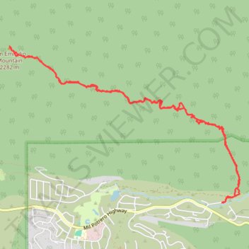
San Emigdio Mountain Eastern Approach
- Distance: 7.1 mi
- Elevation gain: 823 m
- Maximum elevation: 2,276 m
- Elevation loss: 822 m
- Minimum elevation: 1,495 m
- Moving time: 4 h 19 m
- Moving speed: 1.6 mph
- Maximum speed: 3.6 mph
- Total time: 7 h 25 m
- Global speed: 1.0 mph
Interactive trail map
Trail profile
- Distance: 7.1 mi
- Elevation gain: 823 m
- Maximum elevation: 2,276 m
- Elevation loss: 822 m
- Minimum elevation: 1,495 m
- Moving time: 4 h 19 m
- Moving speed: 1.6 mph
- Maximum speed: 3.6 mph
- Total time: 7 h 25 m
- Global speed: 1.0 mph
About this trail
Name: San Emigdio Mountain Eastern Approach trail, distance, elevation, map, profile, GPS track
Coordinates: 34.85388 -119.17899 34.87340 -119.14391