Make a donation
Gear up for your next adventure:
As an Amazon Associate, this site earns from qualifying purchases at no extra cost to you.
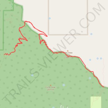
PCT CA-B Fobes Ranch Road to Cedar Spring Junction and back
- Distance: 11.5 mi
- Elevation gain: 809 m
- Maximum elevation: 2,170 m
- Elevation loss: 833 m
- Minimum elevation: 1,557 m
- Moving time: 4 h 54 m
- Moving speed: 2.3 mph
- Maximum speed: 3.5 mph
- Total time: 6 h 12 m
- Global speed: 1.8 mph
Interactive trail map
Make a donation
Gear up for your next adventure:
As an Amazon Associate, this site earns from qualifying purchases at no extra cost to you.
Trail profile
- Distance: 11.5 mi
- Elevation gain: 809 m
- Maximum elevation: 2,170 m
- Elevation loss: 833 m
- Minimum elevation: 1,557 m
- Moving time: 4 h 54 m
- Moving speed: 2.3 mph
- Maximum speed: 3.5 mph
- Total time: 6 h 12 m
- Global speed: 1.8 mph
Make a donation
Gear up for your next adventure:
As an Amazon Associate, this site earns from qualifying purchases at no extra cost to you.
About this trail
Name: PCT CA-B Fobes Ranch Road to Cedar Spring Junction and back trail, distance, elevation, map, profile, GPS track
Start: Fobes Ranch Road, Riverside County, California, 92561, United States (33.67866 -116.61576)
End: Fobes Ranch Road, Riverside County, California, 92561, United States (33.67788 -116.61889)
Coordinates: 33.66624 -116.61889 33.69012 -116.57527
Make a donation
Gear up for your next adventure:
As an Amazon Associate, this site earns from qualifying purchases at no extra cost to you.
Other hiking, mountain biking, running and outdoor activity trails
Click on a trail to view its statistics, map and profile.
Pacific Crest Trail (PCT) through San Bernardino Forest and Santa Rosa and San Jacinto Mountains
United States > California > Riverside County
Hike from Bull Canyon Parking to Snow Creek along the Pacific Crest National Scenic Trail via Lion Peak, Pyramid Peak, Cedar Spring, Palm View Peak, Fobes Saddle, Spitler Peak, Apache Peak, Apache Spring, Antsell Rock, South Peak, Red Tahquitz, Tahquitz Meadow, Powderbox Spring, Middle Spring, Jolley Spring,…
Distance: 59.0 mi • Elevation gain: 3,982 m • Maximum elevation: 2,737 m