Make a donation
Gear up for your next adventure:
As an Amazon Associate, this site earns from qualifying purchases at no extra cost to you.
14-Feb-2025-2323
- Distance: 0.0 mi
- Elevation gain: 2 m
- Maximum elevation: 33 m
- Elevation loss: 2 m
- Minimum elevation: 30 m
- Moving time: 1 m 5 s
- Moving speed: 1.6 mph
- Maximum speed: 3.0 mph
- Total time: 1 m 5 s
- Global speed: 1.6 mph
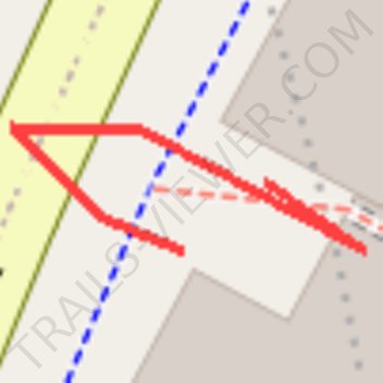
Interactive trail map
Make a donation
Gear up for your next adventure:
As an Amazon Associate, this site earns from qualifying purchases at no extra cost to you.
Trail profile
- Distance: 0.0 mi
- Elevation gain: 2 m
- Maximum elevation: 33 m
- Elevation loss: 2 m
- Minimum elevation: 30 m
- Moving time: 1 m 5 s
- Moving speed: 1.6 mph
- Maximum speed: 3.0 mph
- Total time: 1 m 5 s
- Global speed: 1.6 mph
Make a donation
Gear up for your next adventure:
As an Amazon Associate, this site earns from qualifying purchases at no extra cost to you.
About this trail
Name: 14-Feb-2025-2323 trail, distance, elevation, map, profile, GPS track
Coordinates: -33.88462 151.20323 -33.88455 151.20348
Make a donation
Gear up for your next adventure:
As an Amazon Associate, this site earns from qualifying purchases at no extra cost to you.
Other hiking, mountain biking, running and outdoor activity trails
Click on a trail to view its statistics, map and profile.
Centennial Park - Sydney
Australia > New South Wales > Sydney
#Bike #Centennial #Sydney
Distance: 18.3 mi • Elevation gain: 272 m • Maximum elevation: 74 m
Sydney to Oran Park NSW
Australia > New South Wales > Sydney
Distance: 37.5 mi • Elevation gain: 577 m • Maximum elevation: 126 m