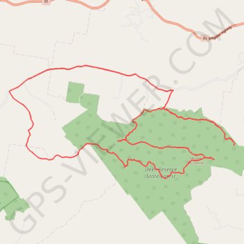
Deer Reserve State Forest - Mount Mcconnel
Interactive trail map
Trail profile
- Distance: 25.1 mi
- Elevation gain: 1,045 m
- Maximum elevation: 483 m
- Elevation loss: 1,045 m
- Minimum elevation: 121 m
About this trail
Name: Deer Reserve State Forest - Mount Mcconnel trail, distance, elevation, map, profile, GPS track
Start: Deer Reserve Road, Woolmar, Somerset Regional, Queensland, Australia (-26.96960 152.49848)
End: Deer Reserve Road, Woolmar, Somerset Regional, Queensland, Australia (-26.96958 152.49856)
Coordinates: -27.00528 152.42382 -26.95940 152.52666