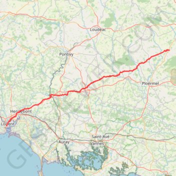
Ors-export-linestring
- Distance: 65.3 mi
- Elevation gain: 1,022 m
- Maximum elevation: 150 m
- Elevation loss: 968 m
- Minimum elevation: 0 m
Interactive trail map
Trail profile
- Distance: 65.3 mi
- Elevation gain: 1,022 m
- Maximum elevation: 150 m
- Elevation loss: 968 m
- Minimum elevation: 0 m
About this trail
Name: Ors-export-linestring trail, distance, elevation, map, profile, GPS track
Coordinates: 47.73802 -3.37139 48.08243 -2.26847