Make a donation
Gear up for your next adventure:
As an Amazon Associate, this site earns from qualifying purchases at no extra cost to you.
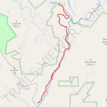
Chattooga River Trail beginning from the parking area off Whiteside Cove Road
- Distance: 6.7 mi
- Elevation gain: 349 m
- Maximum elevation: 888 m
- Elevation loss: 351 m
- Minimum elevation: 787 m
- Moving time: 2 h 33 m
- Moving speed: 2.6 mph
- Maximum speed: 5.2 mph
- Total time: 3 h 6 m
- Global speed: 2.2 mph
Interactive trail map
Make a donation
Gear up for your next adventure:
As an Amazon Associate, this site earns from qualifying purchases at no extra cost to you.
Trail profile
- Distance: 6.7 mi
- Elevation gain: 349 m
- Maximum elevation: 888 m
- Elevation loss: 351 m
- Minimum elevation: 787 m
- Moving time: 2 h 33 m
- Moving speed: 2.6 mph
- Maximum speed: 5.2 mph
- Total time: 3 h 6 m
- Global speed: 2.2 mph
Make a donation
Gear up for your next adventure:
As an Amazon Associate, this site earns from qualifying purchases at no extra cost to you.
About this trail
Name: Chattooga River Trail beginning from the parking area off Whiteside Cove Road trail, distance, elevation, map, profile, GPS track
End: 4123, Whiteside Cove Road, Jackson County, North Carolina, 28741, United States (35.06478 -83.12229)
Coordinates: 35.03284 -83.13060 35.06478 -83.11813
Make a donation
Gear up for your next adventure:
As an Amazon Associate, this site earns from qualifying purchases at no extra cost to you.
Other hiking, mountain biking, running and outdoor activity trails
Click on a trail to view its statistics, map and profile.
Great Smoky Mountains Appalachian Trail
United States > North Carolina > Clay County
Hike through Great Smoky Mountains along Appalachian Trail via Standing Indian, Ridgepole Mountain, Yellow Bald, Wine Spring Bald, Copper Ridge Bald, Cheoah Bald, Wauchecha Bald, Fontana Dam, Thunderhead Mountain, Clingmans Dome, Mount Kephart and Mount Guyot. #Hiking #Mountain #Nature #Forest #Lake…
Distance: 144.0 mi • Elevation gain: 8,873 m • Maximum elevation: 2,013 m