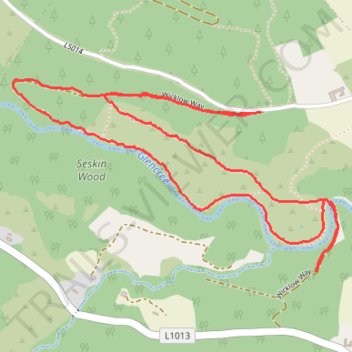
Loop Hike near Knockree
- Distance: 2.5 mi
- Elevation gain: 78 m
- Maximum elevation: 162 m
- Elevation loss: 76 m
- Minimum elevation: 99 m
- Moving time: 55 m 1 s
- Moving speed: 2.7 mph
- Maximum speed: 4.6 mph
- Total time: 59 m 29 s
- Global speed: 2.5 mph
Interactive trail map
Trail profile
- Distance: 2.5 mi
- Elevation gain: 78 m
- Maximum elevation: 162 m
- Elevation loss: 76 m
- Minimum elevation: 99 m
- Moving time: 55 m 1 s
- Moving speed: 2.7 mph
- Maximum speed: 4.6 mph
- Total time: 59 m 29 s
- Global speed: 2.5 mph
About this trail
Name: Loop Hike near Knockree trail, distance, elevation, map, profile, GPS track
Coordinates: 53.16781 -6.23317 53.17325 -6.21783
Other hiking, mountain biking, running and outdoor activity trails
Click on a trail to view its statistics, map and profile.