
Bean Peaks: Green Bean, Mr. Bean, Limey Bean, Franks & Beans; Butter Bean, Refried Beans, Bean There, Bean Sprout, Baked Bean & Magic Bean - Greg
- Distance: 1.0 mi
- Elevation gain: 0 m
- Maximum elevation: 1,873 m
- Elevation loss: 93 m
- Minimum elevation: 1,780 m
- Moving time: 7 m 29 s
- Moving speed: 7.9 mph
- Maximum speed: 15.4 mph
- Total time: 11 m 7 s
- Global speed: 5.3 mph
Interactive trail map
Trail profile
- Distance: 1.0 mi
- Elevation gain: 0 m
- Maximum elevation: 1,873 m
- Elevation loss: 93 m
- Minimum elevation: 1,780 m
- Moving time: 7 m 29 s
- Moving speed: 7.9 mph
- Maximum speed: 15.4 mph
- Total time: 11 m 7 s
- Global speed: 5.3 mph
About this trail
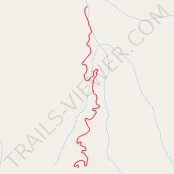
Name: Bean Peaks: Green Bean, Mr. Bean, Limey Bean, Franks & Beans; Butter Bean, Refried Beans, Bean There, Bean Sprout, Baked Bean & Magic Bean - Greg trail, distance, elevation, map, profile, GPS track
Start: Butter Bean #75, Yavapai County, Arizona, 86301, United States (34.48659 -112.46659)
End: Supreme Bean #36, Yavapai County, Arizona, 86301, United States (34.49486 -112.46596)
Coordinates: 34.48659 -112.46680 34.49486 -112.46520
Other hiking, mountain biking, running and outdoor activity trails
Click on a trail to view its statistics, map and profile.
Supreme Bean #36
United States > Arizona > Yavapai County
Downhill, bikes only trail
Distance: 1.5 mi • Elevation gain: 28 m • Maximum elevation: 1,924 m
Bean Peaks: Green Bean, Mr. Bean, Limey Bean, Franks & Beans; Butter Bean, Refried Beans, Bean There, Bean Sprout, Baked Bean & Magic Bean - Greg
United States > Arizona > Yavapai County
Distance: 0.8 mi • Elevation gain: 43 m • Maximum elevation: 1,798 m