Make a donation
Gear up for your next adventure:
As an Amazon Associate, this site earns from qualifying purchases at no extra cost to you.
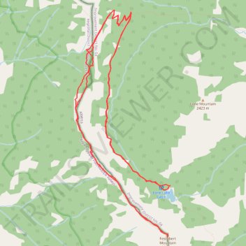
Hike Lone Lake to Festubert Mountain and back
- Distance: 13.0 mi
- Elevation gain: 1,010 m
- Maximum elevation: 2,510 m
- Elevation loss: 1,011 m
- Minimum elevation: 1,892 m
- Moving time: 6 h 1 m
- Moving speed: 2.2 mph
- Maximum speed: 7.4 mph
- Total time: 7 h 42 m
- Global speed: 1.7 mph
Interactive trail map
Make a donation
Gear up for your next adventure:
As an Amazon Associate, this site earns from qualifying purchases at no extra cost to you.
Trail profile
- Distance: 13.0 mi
- Elevation gain: 1,010 m
- Maximum elevation: 2,510 m
- Elevation loss: 1,011 m
- Minimum elevation: 1,892 m
- Moving time: 6 h 1 m
- Moving speed: 2.2 mph
- Maximum speed: 7.4 mph
- Total time: 7 h 42 m
- Global speed: 1.7 mph
Make a donation
Gear up for your next adventure:
As an Amazon Associate, this site earns from qualifying purchases at no extra cost to you.
About this trail
Name: Hike Lone Lake to Festubert Mountain and back trail, distance, elevation, map, profile, GPS track
Start: Tamarack Trail, Improvement District No. 04, Alberta, Canada (49.09013 -114.13194)
End: Tamarack Trail, Improvement District No. 04, Alberta, Canada (49.09031 -114.13148)
Coordinates: 49.08238 -114.15397 49.11759 -114.13141
Make a donation
Gear up for your next adventure:
As an Amazon Associate, this site earns from qualifying purchases at no extra cost to you.
Other hiking, mountain biking, running and outdoor activity trails
Click on a trail to view its statistics, map and profile.
Mount Bauerman and Kootenai Brown Peak
Canada > Alberta > Improvement District No. 04
Distance: 8.9 mi • Elevation gain: 746 m • Maximum elevation: 2,475 m