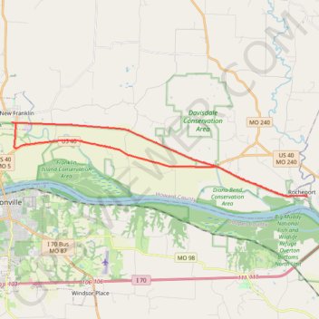
Section of Katy Trail
- Distance: 21.1 mi
- Elevation gain: 157 m
- Maximum elevation: 191 m
- Elevation loss: 158 m
- Minimum elevation: 175 m
- Moving time: 1 h 45 m
- Moving speed: 12.0 mph
- Maximum speed: 24.4 mph
- Total time: 2 h 4 m
- Global speed: 10.2 mph
Interactive trail map
Trail profile
- Distance: 21.1 mi
- Elevation gain: 157 m
- Maximum elevation: 191 m
- Elevation loss: 158 m
- Minimum elevation: 175 m
- Moving time: 1 h 45 m
- Moving speed: 12.0 mph
- Maximum speed: 24.4 mph
- Total time: 2 h 4 m
- Global speed: 10.2 mph
About this trail
Name: Section of Katy Trail trail, distance, elevation, map, profile, GPS track
Start: 1st Street, Rocheport, Boone County, Missouri, 65279, United States (38.97800 -92.56105)
End: 1st Street, Rocheport, Boone County, Missouri, 65279, United States (38.97795 -92.56107)
Coordinates: 38.97775 -92.74012 39.01261 -92.56076