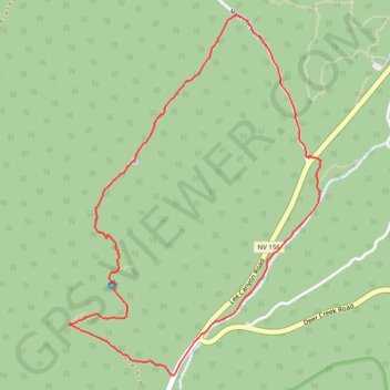
Sisters Ada and Edith Mine and Cabin loop
- Distance: 3.8 mi
- Elevation gain: 353 m
- Maximum elevation: 2,646 m
- Elevation loss: 352 m
- Minimum elevation: 2,303 m
- Moving time: 1 h 57 m
- Moving speed: 1.9 mph
- Maximum speed: 3.4 mph
- Total time: 2 h 51 m
- Global speed: 1.3 mph
Interactive trail map
Trail profile
- Distance: 3.8 mi
- Elevation gain: 353 m
- Maximum elevation: 2,646 m
- Elevation loss: 352 m
- Minimum elevation: 2,303 m
- Moving time: 1 h 57 m
- Moving speed: 1.9 mph
- Maximum speed: 3.4 mph
- Total time: 2 h 51 m
- Global speed: 1.3 mph
About this trail
Name: Sisters Ada and Edith Mine and Cabin loop trail, distance, elevation, map, profile, GPS track
Start: Mack's Canyon Road, Clark County, Nevada, United States (36.34980 -115.64521)
End: Lee Canyon Road, Clark County, Nevada, United States (36.34977 -115.64533)
Coordinates: 36.33856 -115.66060 36.35705 -115.64461