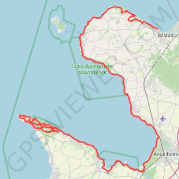
Kullamannen 2021 Sprint Ultra 100km (v2)
- Distance: 68.1 mi
- Elevation gain: 1,556 m
- Maximum elevation: 173 m
- Elevation loss: 1,557 m
- Minimum elevation: 0 m
Interactive trail map
Trail profile
- Distance: 68.1 mi
- Elevation gain: 1,556 m
- Maximum elevation: 173 m
- Elevation loss: 1,557 m
- Minimum elevation: 0 m
About this trail
Name: Kullamannen 2021 Sprint Ultra 100km (v2) trail, distance, elevation, map, profile, GPS track
Start: Papas, Hamngatan, Båstad, Båstads kommun, Skåne County, 269 33, Sweden (56.43524 12.83961)
End: Södra Strandvägen, Mölle, Höganäs kommun, Skåne County, 263 77, Sweden (56.28275 12.49392)
Coordinates: 56.21422 12.45190 56.47008 12.84322