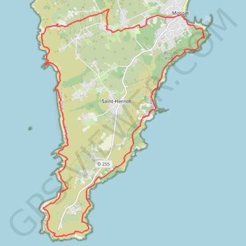
Cap de La Chèvre - Morgat
- Distance: 14.9 mi
- Elevation gain: 904 m
- Maximum elevation: 96 m
- Elevation loss: 903 m
- Minimum elevation: 1 m
Interactive trail map
Trail profile
- Distance: 14.9 mi
- Elevation gain: 904 m
- Maximum elevation: 96 m
- Elevation loss: 903 m
- Minimum elevation: 1 m
About this trail
Name: Cap de La Chèvre - Morgat trail, distance, elevation, map, profile, GPS track
Coordinates: 48.16887 -4.55868 48.22717 -4.49603