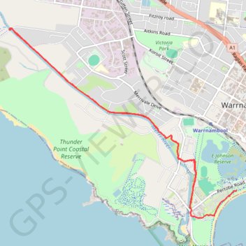
Import a GPX file

Warrnambool

Merri River. #Bike #Merri

  • Distance: 6.3 mi
  • Elevation gain: 57 m
  • Maximum elevation: 8 m
  • Elevation loss: 56 m
  • Minimum elevation: 1 m

Interactive trail map

Trail profile

  • Distance: 6.3 mi
  • Elevation gain: 57 m
  • Maximum elevation: 8 m
  • Elevation loss: 56 m
  • Minimum elevation: 1 m

About this trail

Gear up for your next adventure:

🧥Packable Down Jackets - Lightweight warmth that compresses small in your bag
🧼Biodegradable Soap - Leave-no-trace hygiene for multi-day mountain treks
Altimeter Watches - Watches measuring altitude for mountain activities
🦶Anti-Blister Balms - Protect your feet before long topographic expeditions
🥾Hiking Boots - Waterproof and durable boots for long-distance hiking in the UK

As an Amazon Associate, this site earns from qualifying purchases at no extra cost to you.