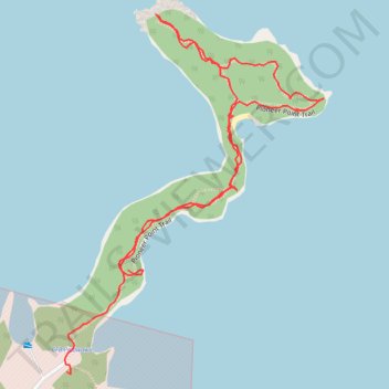
Pioneer Point Trail
- Distance: 1.0 mi
- Elevation gain: 11 m
- Maximum elevation: 117 m
- Elevation loss: 13 m
- Minimum elevation: 112 m
- Moving time: 29 m 28 s
- Moving speed: 2.0 mph
- Maximum speed: 3.7 mph
- Total time: 44 m 5 s
- Global speed: 1.3 mph
Interactive trail map
Trail profile
- Distance: 1.0 mi
- Elevation gain: 11 m
- Maximum elevation: 117 m
- Elevation loss: 13 m
- Minimum elevation: 112 m
- Moving time: 29 m 28 s
- Moving speed: 2.0 mph
- Maximum speed: 3.7 mph
- Total time: 44 m 5 s
- Global speed: 1.3 mph
About this trail
Name: Pioneer Point Trail trail, distance, elevation, map, profile, GPS track
Coordinates: 45.92148 -77.26988 45.92573 -77.26549
Other hiking, mountain biking, running and outdoor activity trails
Click on a trail to view its statistics, map and profile.