Make a donation
Gear up for your next adventure:
As an Amazon Associate, this site earns from qualifying purchases at no extra cost to you.
Somerset Lookout
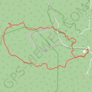
Interactive trail map
Make a donation
Gear up for your next adventure:
As an Amazon Associate, this site earns from qualifying purchases at no extra cost to you.
Trail profile
- Distance: 7.9 mi
- Elevation gain: 339 m
- Maximum elevation: 646 m
- Elevation loss: 335 m
- Minimum elevation: 458 m
- Moving time: 2 h 11 m
- Moving speed: 3.6 mph
- Maximum speed: 8.1 mph
- Total time: 2 h 18 m
- Global speed: 3.4 mph
Make a donation
Gear up for your next adventure:
As an Amazon Associate, this site earns from qualifying purchases at no extra cost to you.
About this trail
Name: Somerset Lookout trail, distance, elevation, map, profile, GPS track
Coordinates: -27.10300 152.66304 -27.08338 152.70314
Make a donation
Gear up for your next adventure:
As an Amazon Associate, this site earns from qualifying purchases at no extra cost to you.
Other hiking, mountain biking, running and outdoor activity trails
Click on a trail to view its statistics, map and profile.
Make a donation
Gear up for your next adventure:
As an Amazon Associate, this site earns from qualifying purchases at no extra cost to you.
Somerset Trail
Distance: 8.0 mi • Elevation gain: 345 m • Maximum elevation: 646 m