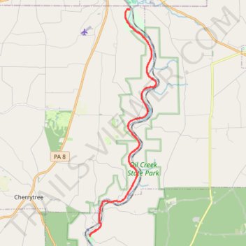
Oil Creek Trail to Petroleum Center
- Distance: 19.3 mi
- Elevation gain: 444 m
- Maximum elevation: 385 m
- Elevation loss: 444 m
- Minimum elevation: 323 m
- Moving time: 1 h 42 m
- Moving speed: 11.3 mph
- Maximum speed: 26.7 mph
- Total time: 1 h 51 m
- Global speed: 10.4 mph
Interactive trail map
Trail profile
- Distance: 19.3 mi
- Elevation gain: 444 m
- Maximum elevation: 385 m
- Elevation loss: 444 m
- Minimum elevation: 323 m
- Moving time: 1 h 42 m
- Moving speed: 11.3 mph
- Maximum speed: 26.7 mph
- Total time: 1 h 51 m
- Global speed: 10.4 mph
About this trail
Name: Oil Creek Trail to Petroleum Center trail, distance, elevation, map, profile, GPS track
Coordinates: 41.51537 -79.68230 41.61578 -79.64274