Make a donation
Gear up for your next adventure:
As an Amazon Associate, this site earns from qualifying purchases at no extra cost to you.
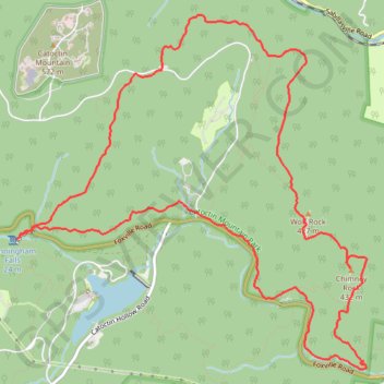
Chimney Rock, Thurmont Vista, Blue Ridge Summit Vista, Hog Rock and Cunningham Falls Loop
This loop hike in Catoctin Mountain Park offers a dynamic journey through diverse terrain, highlighting Maryland’s scenic views and rock formations. Starting at Chimney Rock, hikers can enjoy panoramic views over the Piedmont and continue through forested trails to Wolf Rock and Thurmont Vista, where vistas open up over the Frederick Valley. The trail then leads to Hog Rock and Blue Ridge Summit Vista, with expansive views over the Blue Ridge Mountains, before winding down toward Cunningham Falls, making for a challenging but rewarding trek with rich natural and historic landscapes. #Hiking #Loop #Mountain #Rock #Overlook #Waterfall #Forest #Nature
- Distance: 8.9 mi
- Elevation gain: 492 m
- Maximum elevation: 506 m
- Elevation loss: 490 m
- Minimum elevation: 218 m
- Moving time: 3 h 36 m
- Moving speed: 2.5 mph
- Maximum speed: 9.8 mph
- Total time: 3 h 49 m
- Global speed: 2.3 mph
Interactive trail map
Make a donation
Gear up for your next adventure:
As an Amazon Associate, this site earns from qualifying purchases at no extra cost to you.
Trail profile
- Distance: 8.9 mi
- Elevation gain: 492 m
- Maximum elevation: 506 m
- Elevation loss: 490 m
- Minimum elevation: 218 m
- Moving time: 3 h 36 m
- Moving speed: 2.5 mph
- Maximum speed: 9.8 mph
- Total time: 3 h 49 m
- Global speed: 2.3 mph
Make a donation
Gear up for your next adventure:
As an Amazon Associate, this site earns from qualifying purchases at no extra cost to you.
About this trail
Name: Chimney Rock, Thurmont Vista, Blue Ridge Summit Vista, Hog Rock and Cunningham Falls Loop trail, distance, elevation, map, profile, GPS track
Start: Blue Ridge Summit Trail, Frederick County, Maryland, 21780, United States (39.63381 -77.44985)
Coordinates: 39.62047 -77.47028 39.65109 -77.43092
Make a donation
Gear up for your next adventure:
As an Amazon Associate, this site earns from qualifying purchases at no extra cost to you.
Other hiking, mountain biking, running and outdoor activity trails
Click on a trail to view its statistics, map and profile.
Wolf Rock and Chimney Rock Loop in Catoctin Mountain Park
United States > Maryland > Frederick County
The Wolf Rock and Chimney Rock Loop is a scenic, moderate hike that offers a blend of rocky terrain and breathtaking vistas. As you journey through dense hardwood forests, you'll encounter two major rock formations: Wolf Rock, a vast rocky ridge, and Chimney Rock, a prominent outcrop that provides panoramic…
Distance: 3.8 mi • Elevation gain: 253 m • Maximum elevation: 464 m