
Wolf Hill Loop via World War II Memorial Trail, Ken Weber Trail and Mary Mowry Trail
The Wolf Hill Loop offers a serene hiking experience through the lush woods of the Wolf Hill Forest Preserve. Along the route, hikers can enjoy diverse scenery, including mature oak and maple forests, intriguing rock formations, and the picturesque Mercer Outlook, which provides views of the Providence skyline. Historical elements, like the memorial to airmen from World War II and remnants of old farm roads, add a unique character to this moderately challenging trail, making it a rewarding outing for nature enthusiasts. #Hiking #Loop #Forest #Nature
- Distance: 4.0 mi
- Elevation gain: 113 m
- Maximum elevation: 139 m
- Elevation loss: 112 m
- Minimum elevation: 68 m
- Moving time: 1 h 28 m
- Moving speed: 2.7 mph
- Maximum speed: 10.0 mph
- Total time: 1 h 32 m
- Global speed: 2.6 mph
Interactive trail map
Trail profile
- Distance: 4.0 mi
- Elevation gain: 113 m
- Maximum elevation: 139 m
- Elevation loss: 112 m
- Minimum elevation: 68 m
- Moving time: 1 h 28 m
- Moving speed: 2.7 mph
- Maximum speed: 10.0 mph
- Total time: 1 h 32 m
- Global speed: 2.6 mph
About this trail
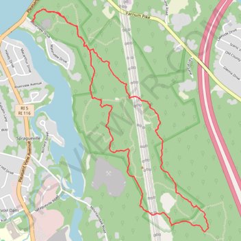
Name: Wolf Hill Loop via World War II Memorial Trail, Ken Weber Trail and Mary Mowry Trail trail, distance, elevation, map, profile, GPS track
Coordinates: 41.88349 -71.54078 41.90050 -71.52270
Other hiking, mountain biking, running and outdoor activity trails
Click on a trail to view its statistics, map and profile.

Dedham-Providence-Dedham
United States > Massachusetts > Norfolk County > Dedham
Distance: 126.0 mi • Elevation gain: 1,811 m • Maximum elevation: 167 m