Rogyott nyomkodás 8/10 R4C GP5000 Dk2
Már itthon éreztem, hoyg szarok a lábaim, aztán az első felfelén kiderült, hogy mégse szarok, hanem full fosok. De azért nyomkodtam, jó szarul esett, aztán kicsit jobb lett. Elmászott a szegmensről a Garmin, de kört nyomtam. 1:14:14 lett, 38,5 avg, 287w/324NP, 30 watt hiányzott ma, de így se lassú, egy 1,4%-os pályán.
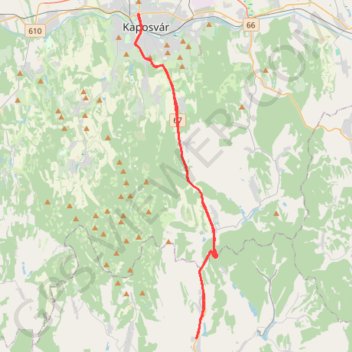
- Distance: 32.5 mi
- Elevation gain: 751 m
- Maximum elevation: 267 m
- Elevation loss: 748 m
- Minimum elevation: 131 m
Interactive trail map
Trail profile
- Distance: 32.5 mi
- Elevation gain: 751 m
- Maximum elevation: 267 m
- Elevation loss: 748 m
- Minimum elevation: 131 m
About this trail
Name: Rogyott nyomkodás 8/10 R4C GP5000 Dk2 trail, distance, elevation, map, profile, GPS track
Coordinates: 46.16247 17.77951 46.36465 17.85292