Import a GPX file

Gibb River Road: Kununurra - Derby

#Bike

  • Distance: 438.3 mi
  • Elevation gain: 3,157 m
  • Maximum elevation: 548 m
  • Elevation loss: 3,193 m
  • Minimum elevation: 4 m

Interactive trail map

Trail profile

  • Distance: 438.3 mi
  • Elevation gain: 3,157 m
  • Maximum elevation: 548 m
  • Elevation loss: 3,193 m
  • Minimum elevation: 4 m

About this trail
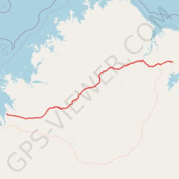
Name: Gibb River Road: Kununurra - Derby trail, distance, elevation, map, profile, GPS track

Start: Kununurra, Shire Of Wyndham-East Kimberley, Western Australia, 6743, Australia (-15.77843 128.74385)

End: Loch Street, Karmulinunga, Derby, Shire Of Derby-West Kimberley, Western Australia, Australia (-17.30933 123.64771)

Coordinates: -17.46121 123.64771 -15.73724 128.74385

Gear up for your next adventure:

🧥Packable Down Jackets - Lightweight warmth that compresses small in your bag
🧴Sport Sunscreen Sticks - High-protection sunblock that won't run into your eyes on the trail
🎿Telescopic Trekking Poles - Reduces knee strain on steep topographic descents
🧵Survival Paracord - Multi-purpose cordage for emergency repairs and shelters
🛌Sleeping Bags - Warm and packable sleeping bags for outdoor nights

As an Amazon Associate, this site earns from qualifying purchases at no extra cost to you.