Horsetail Falls
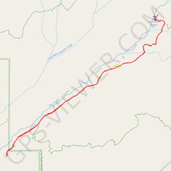
Interactive trail map
Trail profile
- Distance: 4.0 mi
- Elevation gain: 518 m
- Maximum elevation: 2,222 m
- Elevation loss: 518 m
- Minimum elevation: 1,729 m
About this trail
Name: Horsetail Falls trail, distance, elevation, map, profile, GPS track
Start: Deer Creek-Dry Creek Trail, Utah County, Utah, United States (40.48269 -111.75012)
End: Deer Creek-Dry Creek Trail, Utah County, Utah, United States (40.48271 -111.75012)
Coordinates: 40.48269 -111.75012 40.49916 -111.72591
Other hiking, mountain biking, running and outdoor activity trails
Click on a trail to view its statistics, map and profile.
Horsetail Falls via Deer Creek-Dry Creek Trail in Lone Peak Wilderness
United States > Utah > Utah County
The hike to Horsetail Falls via the Deer Creek-Dry Creek Trail offers a rewarding blend of natural beauty and adventure. The trail meanders through a wooded canyon and opens up to sweeping views of Alpine, Utah Lake, the rugged cliffs of the Lone Peak Wilderness, and nearby peaks like The Pfeifferhorn or White…
Distance: 4.2 mi • Elevation gain: 518 m • Maximum elevation: 2,248 m