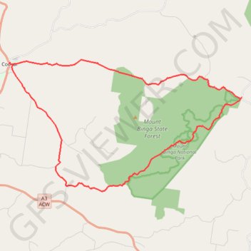
Cooyar - Mount Binga
Interactive trail map
Trail profile
- Distance: 27.7 mi
- Elevation gain: 914 m
- Maximum elevation: 675 m
- Elevation loss: 913 m
- Minimum elevation: 422 m
About this trail
Name: Cooyar - Mount Binga trail, distance, elevation, map, profile, GPS track
Start: Fergus Street, Cooyar, Toowoomba Regional, Queensland, 4402, Australia (-26.98156 151.83179)
End: Fergus Street, Cooyar, Toowoomba Regional, Queensland, 4402, Australia (-26.98152 151.83186)
Coordinates: -27.06068 151.83160 -26.97983 151.99145