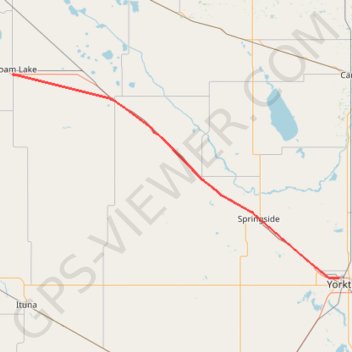
Import a GPX file

Foam Lake - Yorkton

#Bike #Foam #Yorkton

  • Distance: 56.6 mi
  • Elevation gain: 109 m
  • Maximum elevation: 563 m
  • Elevation loss: 163 m
  • Minimum elevation: 504 m

Interactive trail map

Trail profile

  • Distance: 56.6 mi
  • Elevation gain: 109 m
  • Maximum elevation: 563 m
  • Elevation loss: 163 m
  • Minimum elevation: 504 m

About this trail

Name: Foam Lake - Yorkton trail, distance, elevation, map, profile, GPS track

Start: Foam Lake Campground, Highway 310, Foam Lake, Foam Lake No. 276, Saskatchewan, S0A 1A0, Canada (51.63527 -103.53627)

End: Park Road, Yorkton, Saskatchewan, S3N 4B4, Canada (51.22430 -102.48327)

Coordinates: 51.22430 -103.53941 51.63753 -102.48234

Other hiking, mountain biking, running and outdoor activity trails

Click on a trail to view its statistics, map and profile.

Lanigan - Foam Lake

Canada > Saskatchewan > Lanigan

#Bike #Lanigan #Foam

Distance: 70.2 mi • Elevation gain: 183 m • Maximum elevation: 565 m

Yorkton - Russell

Canada > Saskatchewan > Yorkton

#Bike #Yorkton #Russell

Distance: 65.3 mi • Elevation gain: 235 m • Maximum elevation: 565 m

Gear up for your next adventure:

🔦LED Camping Lanterns - Illumination for reading maps inside your tent at night
👟Women's Trail Running Shoes - Agile footwear for fell running and technical trails
🔭Compact Hiking Binoculars - Lightweight optics for scouting terrain and spotting wildlife
🪓Outdoor Multitools - Versatile tools for hiking and camping
🥾Men's Waterproof Hiking Boots - Durable footwear with deep lugs for muddy and rocky UK terrains

As an Amazon Associate, this site earns from qualifying purchases at no extra cost to you.