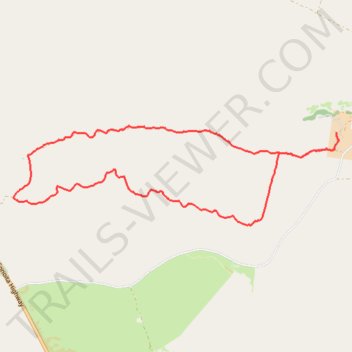
Empire Ranch 10k Trail
- Distance: 6.3 mi
- Elevation gain: 112 m
- Maximum elevation: 1,499 m
- Elevation loss: 113 m
- Minimum elevation: 1,410 m
- Moving time: 1 h 10 m
- Moving speed: 5.3 mph
- Maximum speed: 17.8 mph
- Total time: 1 h 11 m
- Global speed: 5.3 mph
Interactive trail map
Trail profile
- Distance: 6.3 mi
- Elevation gain: 112 m
- Maximum elevation: 1,499 m
- Elevation loss: 113 m
- Minimum elevation: 1,410 m
- Moving time: 1 h 10 m
- Moving speed: 5.3 mph
- Maximum speed: 17.8 mph
- Total time: 1 h 11 m
- Global speed: 5.3 mph
About this trail
Name: Empire Ranch 10k Trail trail, distance, elevation, map, profile, GPS track
Start: Empire Ranch, East Empire Ranch Road, Pima County, Arizona, United States (31.78507 -110.64289)
End: Empire Ranch, East Empire Ranch Road, Pima County, Arizona, United States (31.78526 -110.64287)
Coordinates: 31.77547 -110.68286 31.78588 -110.64263