Wasserman Park
- Distance: 4.2 mi
- Elevation gain: 97 m
- Maximum elevation: 108 m
- Elevation loss: 100 m
- Minimum elevation: 57 m
- Moving time: 55 m 28 s
- Moving speed: 4.5 mph
- Maximum speed: 8.0 mph
- Total time: 55 m 28 s
- Global speed: 4.5 mph
Interactive trail map
Trail profile
- Distance: 4.2 mi
- Elevation gain: 97 m
- Maximum elevation: 108 m
- Elevation loss: 100 m
- Minimum elevation: 57 m
- Moving time: 55 m 28 s
- Moving speed: 4.5 mph
- Maximum speed: 8.0 mph
- Total time: 55 m 28 s
- Global speed: 4.5 mph
About this trail
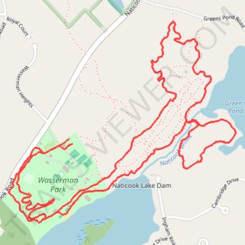
Name: Wasserman Park trail, distance, elevation, map, profile, GPS track
Coordinates: 42.81964 -71.53376 42.82936 -71.51879