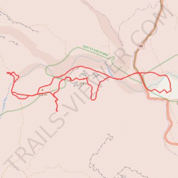
נחל פארן
- Distance: 17.9 mi
- Elevation gain: 527 m
- Maximum elevation: 402 m
- Elevation loss: 526 m
- Minimum elevation: 234 m
- Moving time: 3 h 49 m
- Moving speed: 4.7 mph
- Maximum speed: 8.5 mph
- Total time: 4 h 7 m
- Global speed: 4.3 mph
Interactive trail map
Trail profile
- Distance: 17.9 mi
- Elevation gain: 527 m
- Maximum elevation: 402 m
- Elevation loss: 526 m
- Minimum elevation: 234 m
- Moving time: 3 h 49 m
- Moving speed: 4.7 mph
- Maximum speed: 8.5 mph
- Total time: 4 h 7 m
- Global speed: 4.3 mph
About this trail
Name: נחל פארן trail, distance, elevation, map, profile, GPS track
Coordinates: 30.31461 34.87980 30.33589 34.96914