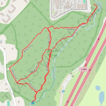
Buxton Gorge
- Distance: 2.4 mi
- Elevation gain: 76 m
- Maximum elevation: 134 m
- Elevation loss: 76 m
- Minimum elevation: 90 m
- Moving time: 51 m 25 s
- Moving speed: 2.7 mph
- Maximum speed: 4.3 mph
- Total time: 55 m 47 s
- Global speed: 2.5 mph
Interactive trail map
Trail profile
- Distance: 2.4 mi
- Elevation gain: 76 m
- Maximum elevation: 134 m
- Elevation loss: 76 m
- Minimum elevation: 90 m
- Moving time: 51 m 25 s
- Moving speed: 2.7 mph
- Maximum speed: 4.3 mph
- Total time: 55 m 47 s
- Global speed: 2.5 mph
About this trail
Name: Buxton Gorge trail, distance, elevation, map, profile, GPS track
Coordinates: 41.23029 -73.68656 41.23723 -73.67831
Other hiking, mountain biking, running and outdoor activity trails
Click on a trail to view its statistics, map and profile.