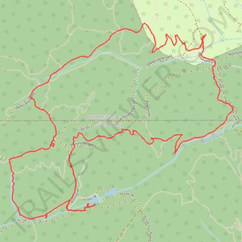
School bus mountain biking route with Mines
- Distance: 6.3 mi
- Elevation gain: 341 m
- Maximum elevation: 2,888 m
- Elevation loss: 343 m
- Minimum elevation: 2,634 m
- Moving time: 2 h 22 m
- Moving speed: 2.7 mph
- Maximum speed: 5.2 mph
- Total time: 2 h 59 m
- Global speed: 2.1 mph
Interactive trail map
Trail profile
- Distance: 6.3 mi
- Elevation gain: 341 m
- Maximum elevation: 2,888 m
- Elevation loss: 343 m
- Minimum elevation: 2,634 m
- Moving time: 2 h 22 m
- Moving speed: 2.7 mph
- Maximum speed: 5.2 mph
- Total time: 2 h 59 m
- Global speed: 2.1 mph
About this trail
Name: School bus mountain biking route with Mines trail, distance, elevation, map, profile, GPS track
Coordinates: 39.92430 -105.54446 39.94026 -105.52066