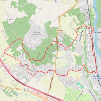
Tédan - Le bois des Bruyères
- Distance: 8.0 mi
- Elevation gain: 253 m
- Maximum elevation: 171 m
- Elevation loss: 252 m
- Minimum elevation: 20 m
Interactive trail map
Trail profile
- Distance: 8.0 mi
- Elevation gain: 253 m
- Maximum elevation: 171 m
- Elevation loss: 252 m
- Minimum elevation: 20 m
About this trail
Name: Tédan - Le bois des Bruyères trail, distance, elevation, map, profile, GPS track
Coordinates: 48.93885 1.95165 48.95626 1.99966
Other hiking, mountain biking, running and outdoor activity trails
Click on a trail to view its statistics, map and profile.
Paris - Mantes-la-Jolie
France > Ile-de-France > Hauts-de-Seine > Boulogne-Billancourt > Jardin de la Mairie
Distance: 32.3 mi • Elevation gain: 524 m • Maximum elevation: 186 m