Import a GPX file

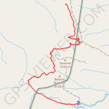
Thukela Falls - Sentinel

#Hiking

  • Distance: 7.9 mi
  • Elevation gain: 1,003 m
  • Maximum elevation: 3,006 m
  • Elevation loss: 1,002 m
  • Minimum elevation: 2,543 m

Interactive trail map

Trail profile

  • Distance: 7.9 mi
  • Elevation gain: 1,003 m
  • Maximum elevation: 3,006 m
  • Elevation loss: 1,002 m
  • Minimum elevation: 2,543 m

About this trail

Other hiking, mountain biking, running and outdoor activity trails

Click on a trail to view its statistics, map and profile.

Lesotho - Semonkong

South Africa > Free State > Thabo Mofutsanyana District Municipality > Maluti-a-Phofung Local Municipality

#Bike #Lesotho

Distance: 355.7 mi • Elevation gain: 16,124 m • Maximum elevation: 3,277 m

Gear up for your next adventure:

🛌Sleeping Bags - Warm and packable sleeping bags for outdoor nights
📻Hand-Crank Emergency Radios - Stay updated on weather warnings in remote areas
🧥Waterproof Hiking Jackets - Rain protection for walking in all weather conditions
🗺️Ordnance Survey Maps - Essential paper maps for hiking across the UK national parks
🚲Bikepacking Frame Bags - Storage for tools and navigation gear on long off-road rides

As an Amazon Associate, this site earns from qualifying purchases at no extra cost to you.