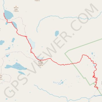
Golden Hinde : Westmin trailhead - Schjelderup Lake
Strathcona Provincial Park. #Hiking #GH #Schjelderup #Strathcona
- Distance: 12.9 mi
- Elevation gain: 1,785 m
- Maximum elevation: 1,720 m
- Elevation loss: 887 m
- Minimum elevation: 387 m
Interactive trail map
Trail profile
- Distance: 12.9 mi
- Elevation gain: 1,785 m
- Maximum elevation: 1,720 m
- Elevation loss: 887 m
- Minimum elevation: 387 m
About this trail
Name: Golden Hinde : Westmin trailhead - Schjelderup Lake trail, distance, elevation, map, profile, GPS track
Coordinates: 49.57492 -125.72376 49.63331 -125.61259