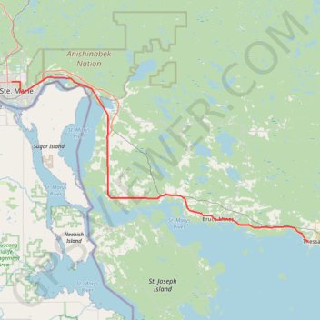
Sault Ste. Marie - Thessalon
Lake Huron. #Bike #SaultSteMarie #Thessalon #Huron
- Distance: 51.8 mi
- Elevation gain: 309 m
- Maximum elevation: 239 m
- Elevation loss: 371 m
- Minimum elevation: 176 m
Interactive trail map
Trail profile
- Distance: 51.8 mi
- Elevation gain: 309 m
- Maximum elevation: 239 m
- Elevation loss: 371 m
- Minimum elevation: 176 m
About this trail
Name: Sault Ste. Marie - Thessalon trail, distance, elevation, map, profile, GPS track
Coordinates: 46.26088 -84.30764 46.54607 -83.56668
Other hiking, mountain biking, running and outdoor activity trails
Click on a trail to view its statistics, map and profile.