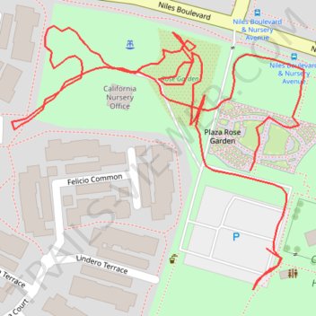
Rose Garden path tracks
- Distance: 0.7 mi
- Elevation gain: 3 m
- Maximum elevation: 22 m
- Elevation loss: 3 m
- Minimum elevation: 19 m
- Moving time: 18 m 34 s
- Moving speed: 2.2 mph
- Maximum speed: 14.1 mph
- Total time: 20 m 26 s
- Global speed: 2.0 mph
Interactive trail map
Trail profile
- Distance: 0.7 mi
- Elevation gain: 3 m
- Maximum elevation: 22 m
- Elevation loss: 3 m
- Minimum elevation: 19 m
- Moving time: 18 m 34 s
- Moving speed: 2.2 mph
- Maximum speed: 14.1 mph
- Total time: 20 m 26 s
- Global speed: 2.0 mph
About this trail
Name: Rose Garden path tracks trail, distance, elevation, map, profile, GPS track
Coordinates: 37.57802 -121.99268 37.57970 -121.99033