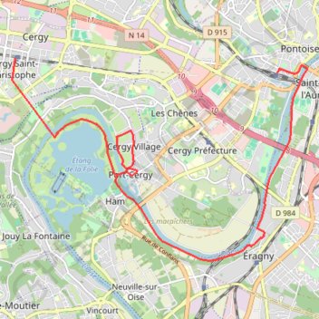
Bords d'Oise de la ville d'art et d'histoire à l'axe majeur - Cergy-Pontoise
- Distance: 8.1 mi
- Elevation gain: 146 m
- Maximum elevation: 108 m
- Elevation loss: 75 m
- Minimum elevation: 22 m
Interactive trail map
Trail profile
- Distance: 8.1 mi
- Elevation gain: 146 m
- Maximum elevation: 108 m
- Elevation loss: 75 m
- Minimum elevation: 22 m
About this trail
Name: Bords d'Oise de la ville d'art et d'histoire à l'axe majeur - Cergy-Pontoise trail, distance, elevation, map, profile, GPS track
Coordinates: 49.01830 2.03348 49.04938 2.10261