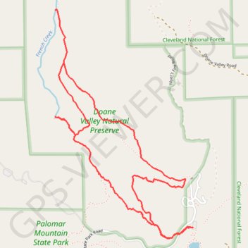
Doane Valley Loop
Loop hike through Doane Valley Natural Preserve via Weir Trail, Weir Historic Site, French Valley Trail, Rest spot between two waterfalls and Doane Valley Nature Trail in Palomar Mountain State Park. #Hiking #Loop #Mountain #Valley #Nature #Forest #Park #River
- Distance: 4.0 mi
- Elevation gain: 156 m
- Maximum elevation: 1,432 m
- Elevation loss: 156 m
- Minimum elevation: 1,365 m
Interactive trail map
Trail profile
- Distance: 4.0 mi
- Elevation gain: 156 m
- Maximum elevation: 1,432 m
- Elevation loss: 156 m
- Minimum elevation: 1,365 m
About this trail
Name: Doane Valley Loop trail, distance, elevation, map, profile, GPS track
Start: Doane Valley Nature Trail, San Diego County, California, United States (33.34152 -116.90153)
End: Doane Valley Nature Trail, San Diego County, California, United States (33.34152 -116.90152)
Coordinates: 33.34076 -116.91288 33.35654 -116.90152
Other hiking, mountain biking, running and outdoor activity trails
Click on a trail to view its statistics, map and profile.