Exeter Walking
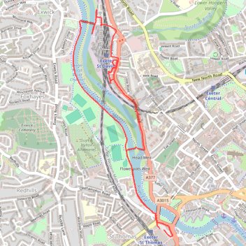
Interactive trail map
Trail profile
- Distance: 3.2 mi
- Elevation gain: 20 m
- Maximum elevation: 19 m
- Elevation loss: 20 m
- Minimum elevation: 6 m
- Moving time: 1 h 19 m
- Moving speed: 2.4 mph
- Maximum speed: 4.0 mph
- Total time: 1 h 19 m
- Global speed: 2.4 mph
About this trail
Name: Exeter Walking trail, distance, elevation, map, profile, GPS track
Start: Alphington Street, St Thomas, Exeter, Devon, England, EX2 8AF, United Kingdom (50.71732 -3.53743)
End: Alphington Street, St Thomas, Exeter, Devon, England, EX2 8AF, United Kingdom (50.71739 -3.53784)
Coordinates: 50.71685 -3.54717 50.73235 -3.53648
Topography: Exeter topographic map, elevation, terrain