Walked the North Cheyenne Canyon trail
- Distance: 0.5 mi
- Elevation gain: 35 m
- Maximum elevation: 2,088 m
- Elevation loss: 31 m
- Minimum elevation: 2,057 m
- Moving time: 13 m 39 s
- Moving speed: 2.3 mph
- Maximum speed: 4.0 mph
- Total time: 14 m 55 s
- Global speed: 2.1 mph
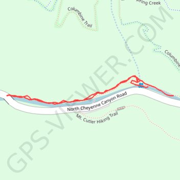
Interactive trail map
Trail profile
- Distance: 0.5 mi
- Elevation gain: 35 m
- Maximum elevation: 2,088 m
- Elevation loss: 31 m
- Minimum elevation: 2,057 m
- Moving time: 13 m 39 s
- Moving speed: 2.3 mph
- Maximum speed: 4.0 mph
- Total time: 14 m 55 s
- Global speed: 2.1 mph
About this trail
Name: Walked the North Cheyenne Canyon trail trail, distance, elevation, map, profile, GPS track
Start: North Cheyenne Canyon Road, El Paso County, Colorado, United States (38.79232 -104.88530)
End: North Cheyenne Canyon Road, El Paso County, Colorado, United States (38.79213 -104.88463)
Coordinates: 38.79196 -104.88909 38.79254 -104.88463
Other hiking, mountain biking, running and outdoor activity trails
Click on a trail to view its statistics, map and profile.
Ladder Extension trail
United States > Colorado > El Paso County > Colorado Springs
North Cheyenne Canyon Park
Distance: 6.0 mi • Elevation gain: 481 m • Maximum elevation: 2,253 m