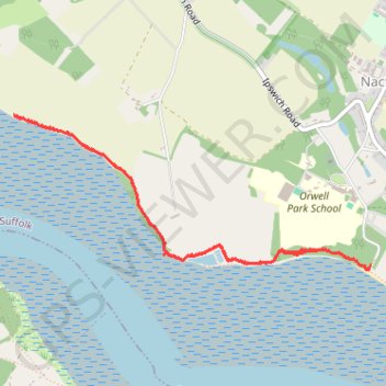
England Coast Path Westwards from Nacton Shore
- Distance: 3.1 mi
- Elevation gain: 49 m
- Maximum elevation: 18 m
- Elevation loss: 52 m
- Minimum elevation: -1 m
- Moving time: 1 h 25 m
- Moving speed: 2.2 mph
- Maximum speed: 3.2 mph
- Total time: 1 h 26 m
- Global speed: 2.1 mph
Interactive trail map
Trail profile
- Distance: 3.1 mi
- Elevation gain: 49 m
- Maximum elevation: 18 m
- Elevation loss: 52 m
- Minimum elevation: -1 m
- Moving time: 1 h 25 m
- Moving speed: 2.2 mph
- Maximum speed: 3.2 mph
- Total time: 1 h 26 m
- Global speed: 2.1 mph
About this trail
Name: England Coast Path Westwards from Nacton Shore trail, distance, elevation, map, profile, GPS track
Coordinates: 52.00577 1.20305 52.01366 1.23266
Topography: Suffolk topographic map, elevation, terrain
Other hiking, mountain biking, running and outdoor activity trails
Click on a trail to view its statistics, map and profile.
England Coast Path Eastwards from Bridge Wood
United Kingdom > England > Suffolk > Ipswich
Distance: 3.4 mi • Elevation gain: 73 m • Maximum elevation: 36 m