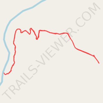
East Fork Obey River
- Distance: 3.0 mi
- Elevation gain: 223 m
- Maximum elevation: 534 m
- Elevation loss: 223 m
- Minimum elevation: 326 m
- Moving time: 47 m 57 s
- Moving speed: 3.8 mph
- Maximum speed: 16.4 mph
- Total time: 1 h 3 m
- Global speed: 2.9 mph
Interactive trail map
Trail profile
- Distance: 3.0 mi
- Elevation gain: 223 m
- Maximum elevation: 534 m
- Elevation loss: 223 m
- Minimum elevation: 326 m
- Moving time: 47 m 57 s
- Moving speed: 3.8 mph
- Maximum speed: 16.4 mph
- Total time: 1 h 3 m
- Global speed: 2.9 mph
About this trail
Name: East Fork Obey River trail, distance, elevation, map, profile, GPS track
Start: Fentress County, Middle Tennessee, Tennessee, 38565, United States (36.24802 -85.03259)
End: Fentress County, Middle Tennessee, Tennessee, 38565, United States (36.24810 -85.03266)
Coordinates: 36.24669 -85.04687 36.25227 -85.03259