
Indian Grave Gap Road and Tray Mountain Road
- Distance: 11.2 mi
- Elevation gain: 502 m
- Maximum elevation: 1,025 m
- Elevation loss: 913 m
- Minimum elevation: 460 m
Interactive trail map
Trail profile
- Distance: 11.2 mi
- Elevation gain: 502 m
- Maximum elevation: 1,025 m
- Elevation loss: 913 m
- Minimum elevation: 460 m
About this trail
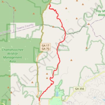
Name: Indian Grave Gap Road and Tray Mountain Road trail, distance, elevation, map, profile, GPS track
Start: Indian Grave Gap Road, Towns County, Georgia, United States (34.81597 -83.72702)
End: 1000, Unicoi Turnpike, White County, Georgia, 30545, United States (34.72016 -83.74737)
Coordinates: 34.72016 -83.74784 34.82258 -83.71386