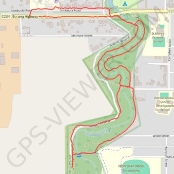
South part of Yarriambiack Creek Trail
- Distance: 2.7 mi
- Elevation gain: 3 m
- Maximum elevation: 113 m
- Elevation loss: 3 m
- Minimum elevation: 110 m
- Moving time: 50 m 56 s
- Moving speed: 3.1 mph
- Maximum speed: 7.5 mph
- Total time: 54 m 33 s
- Global speed: 2.9 mph
Interactive trail map
Trail profile
- Distance: 2.7 mi
- Elevation gain: 3 m
- Maximum elevation: 113 m
- Elevation loss: 3 m
- Minimum elevation: 110 m
- Moving time: 50 m 56 s
- Moving speed: 3.1 mph
- Maximum speed: 7.5 mph
- Total time: 54 m 33 s
- Global speed: 2.9 mph
About this trail
Name: South part of Yarriambiack Creek Trail trail, distance, elevation, map, profile, GPS track
Coordinates: -36.26161 142.38069 -36.25299 142.38837