Make a donation
Gear up for your next adventure:
As an Amazon Associate, this site earns from qualifying purchases at no extra cost to you.
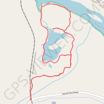
Horseshoe Lake Loop Trail in Denali National Park
The Horseshoe Lake Loop Trail in Denali National Park is a captivating and relatively easy hike that provides hikers with the opportunity to explore diverse landscapes. Along the route, you can enjoy panoramic views of Horseshoe Lake surrounded by vibrant forests, with occasional glimpses of the Nenana River and surrounding mountains. Notable highlights include the chance to observe beaver dams, the tranquil lake shoreline, and wildlife sightings, such as birds and possibly moose. The well-maintained trail offers an ideal balance of scenic beauty and accessibility for hikers of various skill levels. #Hiking #Lake #Loop #River #Forest #Nature #Mountain
- Distance: 2.1 mi
- Elevation gain: 85 m
- Maximum elevation: 527 m
- Elevation loss: 85 m
- Minimum elevation: 456 m
- Moving time: 54 m 54 s
- Moving speed: 2.3 mph
- Maximum speed: 8.9 mph
- Total time: 1 h 5 m
- Global speed: 2.0 mph
Interactive trail map
Make a donation
Gear up for your next adventure:
As an Amazon Associate, this site earns from qualifying purchases at no extra cost to you.
Trail profile
- Distance: 2.1 mi
- Elevation gain: 85 m
- Maximum elevation: 527 m
- Elevation loss: 85 m
- Minimum elevation: 456 m
- Moving time: 54 m 54 s
- Moving speed: 2.3 mph
- Maximum speed: 8.9 mph
- Total time: 1 h 5 m
- Global speed: 2.0 mph
Make a donation
Gear up for your next adventure:
As an Amazon Associate, this site earns from qualifying purchases at no extra cost to you.
About this trail
Name: Horseshoe Lake Loop Trail in Denali National Park trail, distance, elevation, map, profile, GPS track
Start: Denali Park Road, Denali, Alaska, United States (63.73673 -148.91471)
End: Denali Park Road, Denali, Alaska, United States (63.73675 -148.91495)
Coordinates: 63.73673 -148.91495 63.74484 -148.90648
Make a donation
Gear up for your next adventure:
As an Amazon Associate, this site earns from qualifying purchases at no extra cost to you.
Other hiking, mountain biking, running and outdoor activity trails
Click on a trail to view its statistics, map and profile.
Horseshoe Lake Loop Trail in Denali National Park
United States > Alaska > Denali
The Horseshoe Lake Loop Trail offers an enchanting and accessible hiking experience. The route features stunning views of the lake, surrounded by forested areas, and a chance to spot local wildlife like moose and beavers. The loop also takes you past the Nenana River’s rapids and beaver dams, creating a…
Distance: 2.3 mi • Elevation gain: 86 m • Maximum elevation: 527 m
Road Trip Alaska 2018
United States > Alaska > Anchorage
From Anchorage.
Distance: 398.7 mi • Elevation gain: 4,791 m • Maximum elevation: 739 m