Thank you for supporting this site ❤️
Make a donation
Make a donation
Gear up for your next adventure:
As an Amazon Associate, this site earns from qualifying purchases at no extra cost to you.
Several mica mines near Ojo Caliente
- Distance: 8.0 mi
- Elevation gain: 325 m
- Maximum elevation: 2,039 m
- Elevation loss: 325 m
- Minimum elevation: 1,896 m
- Moving time: 3 h 55 m
- Moving speed: 2.0 mph
- Maximum speed: 3.3 mph
- Total time: 5 h 46 m
- Global speed: 1.4 mph
Interactive trail map
Thank you for supporting this site ❤️
Make a donation
Make a donation
Gear up for your next adventure:
As an Amazon Associate, this site earns from qualifying purchases at no extra cost to you.
Trail profile
- Distance: 8.0 mi
- Elevation gain: 325 m
- Maximum elevation: 2,039 m
- Elevation loss: 325 m
- Minimum elevation: 1,896 m
- Moving time: 3 h 55 m
- Moving speed: 2.0 mph
- Maximum speed: 3.3 mph
- Total time: 5 h 46 m
- Global speed: 1.4 mph
Thank you for supporting this site ❤️
Make a donation
Make a donation
Gear up for your next adventure:
As an Amazon Associate, this site earns from qualifying purchases at no extra cost to you.
About this trail
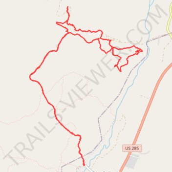
Name: Several mica mines near Ojo Caliente trail, distance, elevation, map, profile, GPS track
Coordinates: 36.30525 -106.06247 36.33163 -106.03932
Thank you for supporting this site ❤️
Make a donation
Make a donation
Gear up for your next adventure:
As an Amazon Associate, this site earns from qualifying purchases at no extra cost to you.