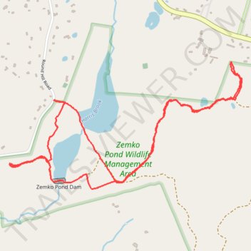
Hiking trail in Zemko Pond Wildlife Management Area
- Distance: 3.4 mi
- Elevation gain: 80 m
- Maximum elevation: 176 m
- Elevation loss: 80 m
- Minimum elevation: 134 m
- Moving time: 1 h 29 m
- Moving speed: 2.3 mph
- Maximum speed: 3.3 mph
- Total time: 1 h 55 m
- Global speed: 1.8 mph
Interactive trail map
Trail profile
- Distance: 3.4 mi
- Elevation gain: 80 m
- Maximum elevation: 176 m
- Elevation loss: 80 m
- Minimum elevation: 134 m
- Moving time: 1 h 29 m
- Moving speed: 2.3 mph
- Maximum speed: 3.3 mph
- Total time: 1 h 55 m
- Global speed: 1.8 mph
About this trail
Name: Hiking trail in Zemko Pond Wildlife Management Area trail, distance, elevation, map, profile, GPS track
Coordinates: 41.49612 -72.25877 41.50371 -72.24022