Import a GPX file

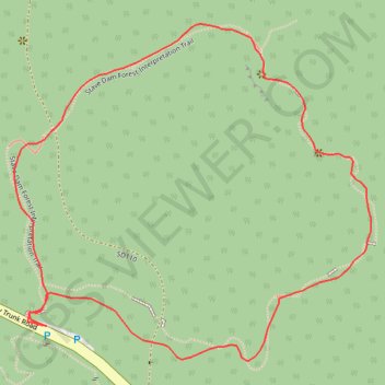
Stave Dam Forest Interpretation Trail

Mission Municipal Forest. #Hiking #Loop

  • Distance: 1.0 mi
  • Elevation gain: 115 m
  • Maximum elevation: 263 m
  • Elevation loss: 116 m
  • Minimum elevation: 149 m

Interactive trail map

Trail profile

  • Distance: 1.0 mi
  • Elevation gain: 115 m
  • Maximum elevation: 263 m
  • Elevation loss: 116 m
  • Minimum elevation: 149 m

About this trail

Other hiking, mountain biking, running and outdoor activity trails

Click on a trail to view its statistics, map and profile.

Vancouver - Golden

Canada > British Columbia > Metro Vancouver Regional District > Vancouver

#Bike #Vancouver #Golden

Distance: 514.2 mi • Elevation gain: 9,376 m • Maximum elevation: 1,347 m

Gear up for your next adventure:

🍳Camping Stoves - Compact stoves for outdoor cooking
Lightweight Tents - Compact tents for backpacking and trekking
🛰️Handheld GPS Devices - Reliable GPS units for hiking and outdoor navigation
📦Compression Sacks - Reduce backpack volume efficiently
🔋Solar Power Banks - Keep your GPS and phone charged during multi-day expeditions

As an Amazon Associate, this site earns from qualifying purchases at no extra cost to you.