Munro hillwalk Carn Bhac
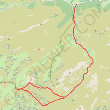
Interactive trail map
Trail profile
- Distance: 17.4 mi
- Elevation gain: 731 m
- Maximum elevation: 947 m
- Elevation loss: 731 m
- Minimum elevation: 354 m
- Moving time: 5 h 3 m
- Moving speed: 3.4 mph
- Maximum speed: 18.3 mph
- Total time: 5 h 41 m
- Global speed: 3.1 mph
About this trail
Name: Munro hillwalk Carn Bhac trail, distance, elevation, map, profile, GPS track
Start: C1M, Muckle Inverey, Inverey, Aberdeenshire, Scotland, AB35 5YB, United Kingdom (56.98514 -3.50001)
End: C1M, Muckle Inverey, Inverey, Aberdeenshire, Scotland, AB35 5YB, United Kingdom (56.98513 -3.50005)
Coordinates: 56.91459 -3.57686 56.98520 -3.47942
Topography: Aberdeenshire topographic map, elevation, terrain
Other hiking, mountain biking, running and outdoor activity trails
Click on a trail to view its statistics, map and profile.
Planned eMTB Gravel: Linn of Dee -> The Red House Bothy - TnB
United Kingdom > Scotland > Aberdeenshire
Following the River Dee west from the Linn of Dee
Distance: 9.5 mi • Elevation gain: 100 m • Maximum elevation: 441 m