Foel Ganol Ridge Loop Hike
- Distance: 5.2 mi
- Elevation gain: 446 m
- Maximum elevation: 550 m
- Elevation loss: 446 m
- Minimum elevation: 200 m
- Moving time: 2 h 41 m
- Moving speed: 1.9 mph
- Maximum speed: 3.3 mph
- Total time: 3 h 36 m
- Global speed: 1.4 mph
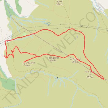
Interactive trail map
Trail profile
- Distance: 5.2 mi
- Elevation gain: 446 m
- Maximum elevation: 550 m
- Elevation loss: 446 m
- Minimum elevation: 200 m
- Moving time: 2 h 41 m
- Moving speed: 1.9 mph
- Maximum speed: 3.3 mph
- Total time: 3 h 36 m
- Global speed: 1.4 mph
About this trail
Name: Foel Ganol Ridge Loop Hike trail, distance, elevation, map, profile, GPS track
Coordinates: 53.21970 -3.98507 53.23105 -3.94764
Topography: Gwynedd topographic map, elevation, terrain
Other hiking, mountain biking, running and outdoor activity trails
Click on a trail to view its statistics, map and profile.
Hillwalk Carnedd Dafydd LLewelyn Foel-fras
United Kingdom > Wales > Conwy
Distance: 13.0 mi • Elevation gain: 1,261 m • Maximum elevation: 1,060 m
Conwy Hiking
United Kingdom > Wales > Conwy > Caerhun
Distance: 11.2 mi • Elevation gain: 212 m • Maximum elevation: 969 m