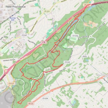
Lake Surprise
- Distance: 9.5 mi
- Elevation gain: 254 m
- Maximum elevation: 158 m
- Elevation loss: 260 m
- Minimum elevation: 68 m
- Moving time: 1 h 58 m
- Moving speed: 4.8 mph
- Maximum speed: 23.3 mph
- Total time: 2 h 29 m
- Global speed: 3.8 mph
Interactive trail map
Trail profile
- Distance: 9.5 mi
- Elevation gain: 254 m
- Maximum elevation: 158 m
- Elevation loss: 260 m
- Minimum elevation: 68 m
- Moving time: 1 h 58 m
- Moving speed: 4.8 mph
- Maximum speed: 23.3 mph
- Total time: 2 h 29 m
- Global speed: 3.8 mph
About this trail
Name: Lake Surprise trail, distance, elevation, map, profile, GPS track
Start: Glenside Avenue, Summit, Union County, New Jersey, 07922, United States (40.69887 -74.36564)
Coordinates: 40.66119 -74.40065 40.69940 -74.36388