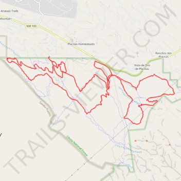
Placitas Mountain Biking Trails
- Distance: 14.8 mi
- Elevation gain: 421 m
- Maximum elevation: 1,817 m
- Elevation loss: 421 m
- Minimum elevation: 1,637 m
- Moving time: 2 h 21 m
- Moving speed: 6.3 mph
- Maximum speed: 19.2 mph
- Total time: 2 h 38 m
- Global speed: 5.6 mph
Interactive trail map
Trail profile
- Distance: 14.8 mi
- Elevation gain: 421 m
- Maximum elevation: 1,817 m
- Elevation loss: 421 m
- Minimum elevation: 1,637 m
- Moving time: 2 h 21 m
- Moving speed: 6.3 mph
- Maximum speed: 19.2 mph
- Total time: 2 h 38 m
- Global speed: 5.6 mph
About this trail
Name: Placitas Mountain Biking Trails trail, distance, elevation, map, profile, GPS track
Coordinates: 35.28771 -106.51334 35.30485 -106.46137